Grand County Precinct Maps
COUNTY PRECINCT MAP, COUNTY DISTRICT MAP, STATE CONGRESSIONAL DISTRICT MAPS, AND FEDERAL CONGRESSIONAL DISTRICT MAP
Please click on each map below to see a full-screen version.
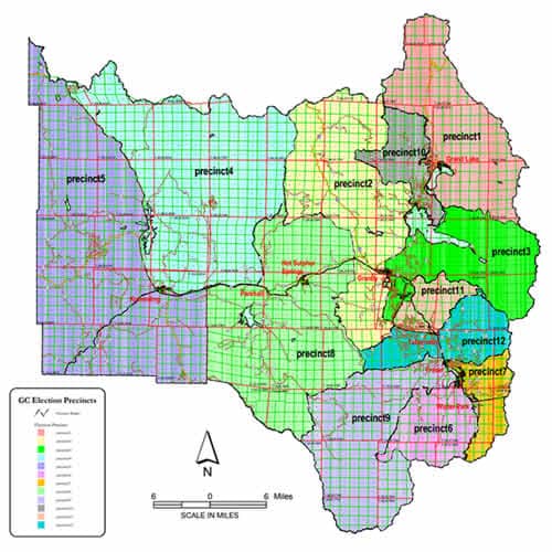
County Precincts Map
Grand County Precinct Maps are important In Colorado because your exact residence location in the county determines which local precinct you are in and this determines which local election voter ballots that you will receive. For example, if you live in a rural area outside of any town or village boundaries, then you will not receive ballots for local town offices or their ballot initiatives. However, if you live within town boundaries, you will be receiving these local town ballots in the mail, if you are properly registered. If you are uncertain as to which precinct you reside in, you can contact the Grand County Clerk’s Office in Hot Sulphur Springs to verify your registration is complete and your residence location is properly assigned to place you in a specific precinct. These precincts also are used to determine Grand County Republican Central Committee membership, with one member selected from each precinct.
Click here to see a full-screen map on the Grand County website.
Click here to see a dynamic full-screen map from arcgis.com.
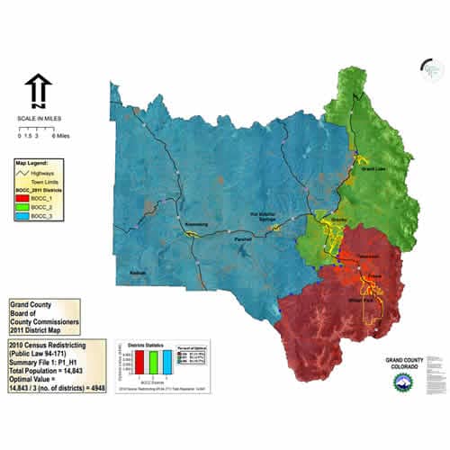
County Districts Map
Grand County is divided into three districts, which are used to determine which County Commissioner represents the district you reside in. These districts also are used to determine mailing of voting ballots for election of Grand County Board of County Commissioner (BOCC) candidates.
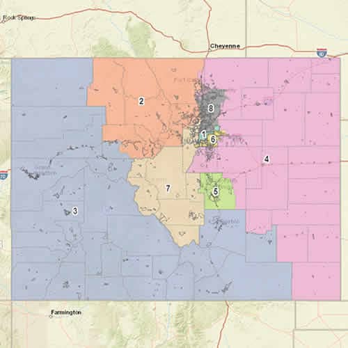
Federal Congressional Districts Map
Colorado is currently divided into eight Federal Congressional Districts for purposes of voting for U.S. Congress personnel from Colorado, to serve in the U.S. House of Representatives in Washington D.C. Grand County is currently assigned in Congressional District 2; however, Colorado is currently undergoing federal congressional redistricting based on revised census data from the 2020 census, so their may be additional redistricting occurring over the next 12 months, and these current Federal Congressional District maps may be subject to further change.
Click here to see a dynamic full-screen map from arcgis.com.
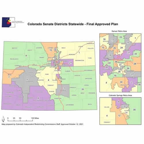
CO State Senate Districts Map
With recent updates and changes to Colorado State Legislative Maps, these updated maps are provided for purposes of selecting candidates and voting for personnel to represent Grand County in the Colorado State Legislature. Grand County is currently in Senate District 8, which includes 10 counties in northwest Colorado, including Grand, Gilpin, Jackson, Routt, Rio Blanco, Moffatt, Garfield, Eagle, Clear Creek, and Summit Counties.
Click here to see a dynamic full-screen map from arcgis.com.
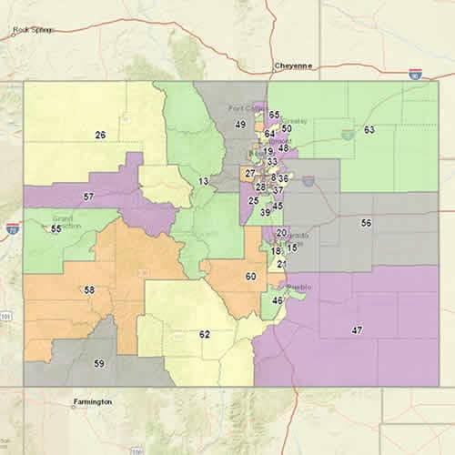
Colorado State House Districts Map
With recent updates and changes to Colorado State Legislative Maps, these updated maps are provided for purposes of selecting candidates and voting for personnel to represent Grand County in the Colorado State Legislature. Grand County is currently in House District 13, which includes 6 counties in central Colorado, including Grand, Jackson, Park, Lake, Chaffee, and Summit Counties.
Click here to see a dynamic full-screen map from arcgis.com.